Austria is a country that could be defined by hiking. With the mighty Alps offering the chance to get out into nature, and dare I say, Get away from it all, Hiking is very much part of the national psyche. This is great for the people of Salzburg, Stieremark and the Tirol, where finding a mountain to climb is simple. For those who live in the Austrian Capital, things can seem a little more tricky. Vienna sits out on the marches that lead to Slovakia and the Czech Republic. These flatlands differ wildly from the mountainous peaks seen further west. That doesn’t mean there isn’t an opportunity to get out into nature, and even find the odd place to climb. The City of Vienna has a plan, and it’s called the Stadtwanderweg.
The Stadtwanderweg network.
Within and around Vienna, the city has a network of Stadtwanderweg, a wonderful German compound that translates to roughly City wander ways. Made up of 11 paths, some of which also offer an alternate path as well, the Stadtwanderwegs are designed to get city dwellers out into nature. Each path is different, with some taking in the hills around the city, while others offer you a stroll out on the marches. Today, I’m starting at the beginning and taking on Stadtwanderweg 1. The weather is warm, but not hot, and I’m looking forward to a day out amongst nature.
The Route.
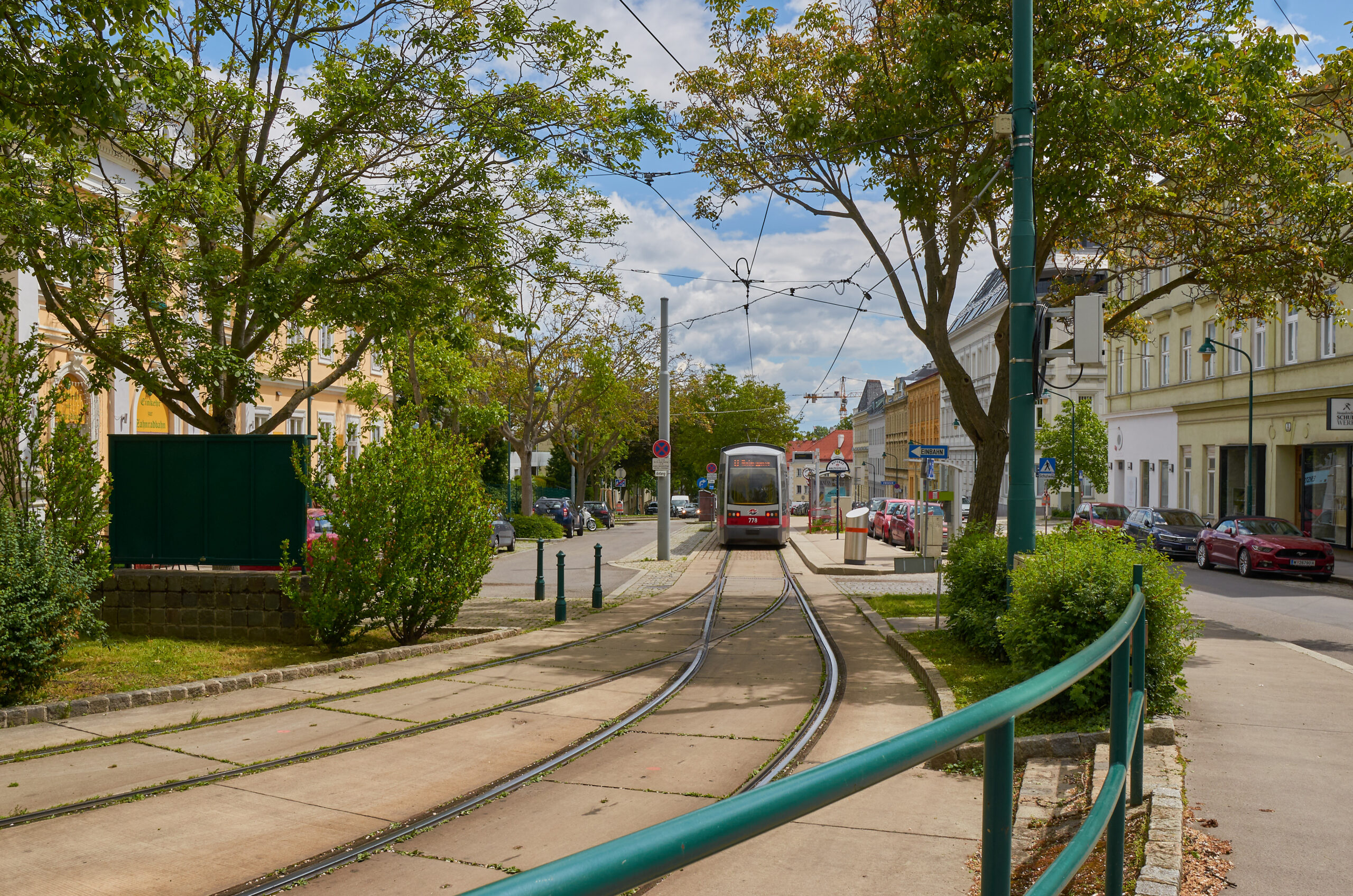
Stadtwanderweg 1 begins and ends in the 19th district, at the end of tramline D, known as Nußdorf. from there, the path takes us through Beethoven country, of which I’ll talk a little about later. From there, we head into the woods, all the time climbing up to the Kahlerberg, a large multiuser area above the city before the path begins its descent back down to Nußdorf via the various vineyards along the way. There’s even a chance to branch off onto Stadtwanderweg 1a that takes you further out along the main route, heading down to Nußdorf via the Danube river itself. The whole route should take around three or so hours.
Leaving the City behind.
From the tram stop, I cross the road and immediately find the signpost pointing the way ahead. It’s an hour and a half walk to the Kahlerberg, which marks the halfway point more or less. With the sun shining, I head off along the path. Like nearby Grinzing, Nußdorf is somewhat unspoilt compared to the city itself, and there’s a feeling of stepping back in time when you’re walking here. Nowhere is this more evident than the discovery of this old fashioned ‘Pissoir’ or men’s toilet. They don’t make them like this anymore, and for good reason.
Leaving the old WC behind, I continue on along Beethovengang, which forms the first part of Stadtwanderweg 1. Beethoven is very much a feature of the 19th district and Nußdorf in particular. The German-born composer spent most of his life in Vienna and nearby Heiligenstadt, which at the time was far outside the city limits. As such, our route takes in Beethoven Park, complete with a suitable statue of the composer. The park is pretty large and worthy of an article in itself. Today though, there are plenty of people out and about, enjoying the park, all the while as Beethoven scowls at them from his pedestal.
The path continues and once again I come across my old friend, St. (Insert Name Here.) If you’d read my last post about Grinzing, (And if you haven’t, just click Here) You’ll know that I came across a statue that I didn’t take note of who it represents. It looks like he’s back again, and this time, I find there’s no identification on the statue. However, I believe this is Saint Leopold, who is interred near here in Klosterneuburg Monastery. He’s often found along roadsides in this area.
From our Saint, the path continues alongside a small stream. What is noticeable is that I’ve been heading uphill ever since I stepped off the tram. The gentle climb isn’t troublesome, but I’m certainly aware that I’m not on level ground. It’s also clear that Nußdorf is slowly ‘thinning out’ as I walk. The last signs of Nußdorf I come across is the Cemetary. Niki Lauda is at rest here, alongside a few other notable locals. I leave them in peace, but for those who would like to visit, I’ll leave details below.
Into the Countryside.
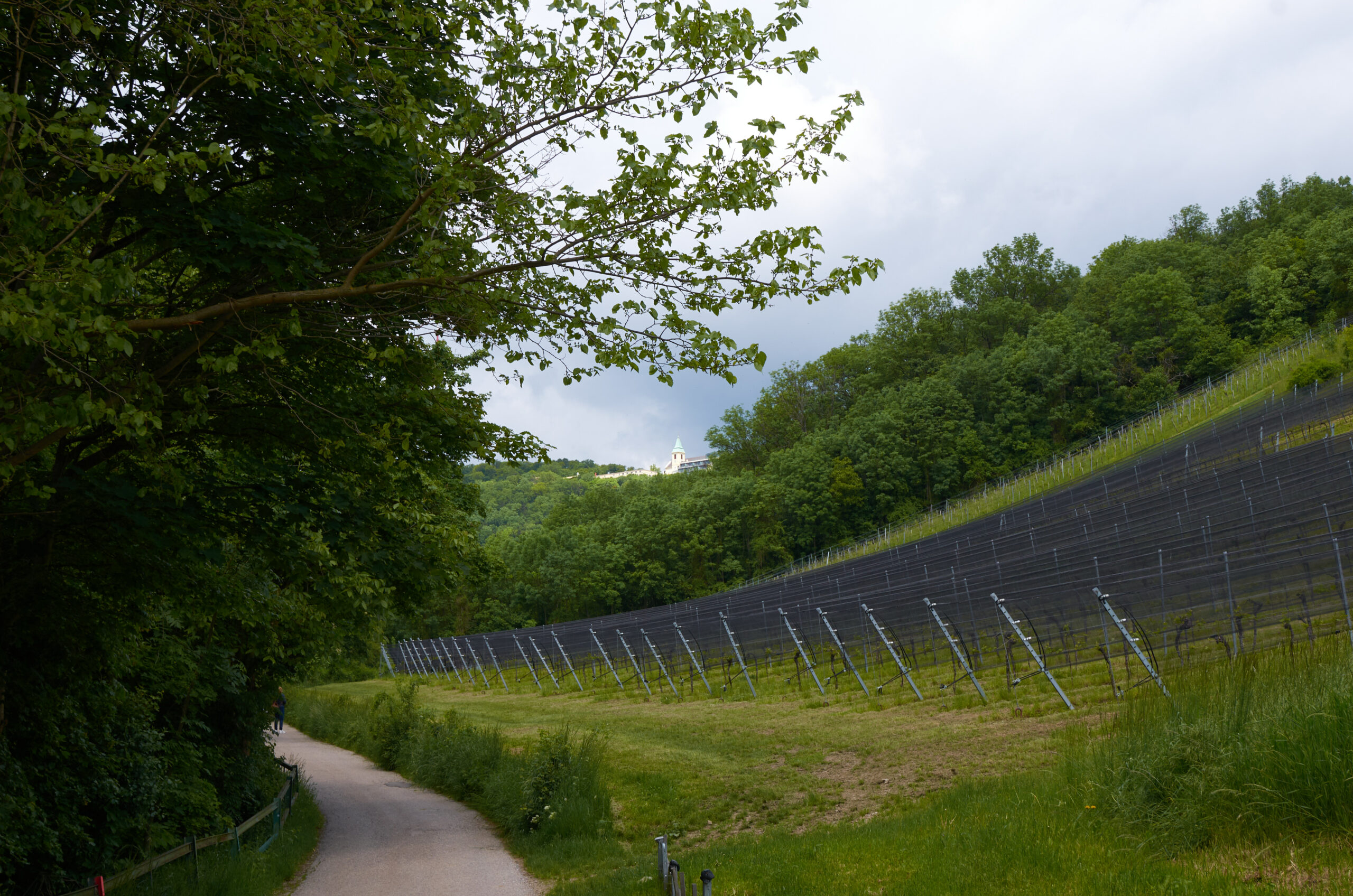
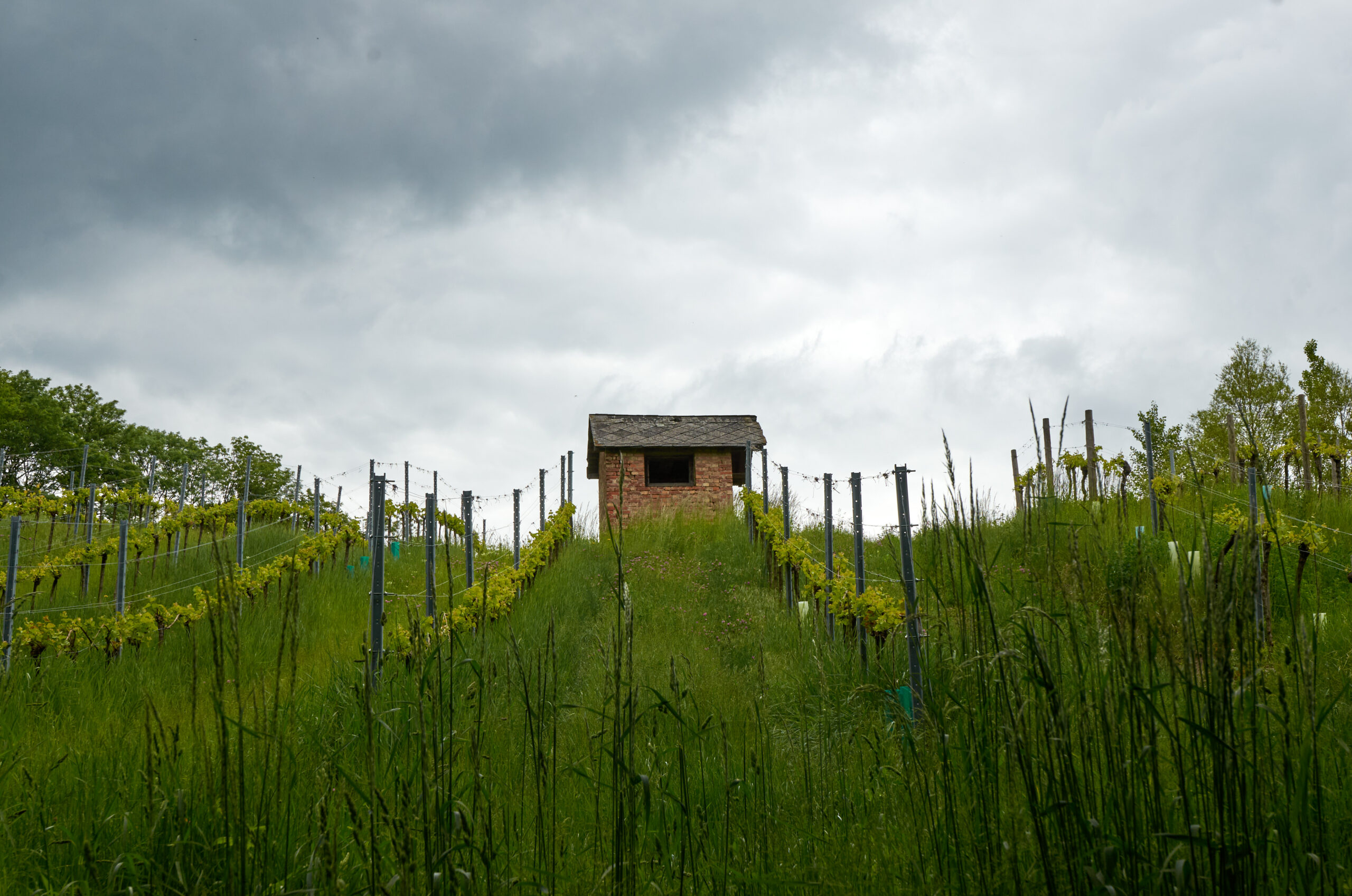
As I expected, the world falls away and all to soon I’m out into the countryside and among the Vineyards that litter the hills. It’s pretty nice to be in the peace and quiet, and the views are nice. It’s also a busy route. Several people are ahead of me and I pass more than a few people heading the opposite direction. As I look around the rolling hills the path follows, it’s easy to see why this is such a popular route. As I wander by one particular Vineyard, out of the corner of my eye I see something move. Its a deer and I manage to grab a shot of it before it disappeared into the woods.
It’s also around this time that I catch sight of the Kahlerberg. It still way up above and I wonder how much longer I have to walk until it reaches its terrace. Fortunately, the path is well signposted. It’s still another 35 minutes of walking or so, and that’s ok. So far I’ve been walking for around 35 to 40 minutes and I’m feeling pretty good. Speaking of signposts, should you be worried that you’ll lose your way, there markers all along the route to help you stay on course.
At this point, for that last 35-minute walk, the path turns from a nice asphalt surface to something more challenging. The dirt track also begins to head upwards and more an incline, and the climb becomes more noticeable. After a few months of lockdown, this is a great way to start losing the COVID 5kg everyone’s put on. The track does get a little more tricky, and you wouldn’t want to climb this when it’s wet, but overall, it’s nothing too strenuous. From in the woods, I hear the sound of a distant woodpecker doing its thing, but as the climb continues, there are sounds of civilisation creeping in. distant road noise indicates I’m reaching the summit and before I know it, I pop out at the side of the road. From here it’s a 10-minute walk, mostly on the flat to the Kahlerberg.
If you feel like a drink before you get there, you’ll find a cafe next to the road where you can enjoy a well-deserved break after the climb. I push on. The path follows alongside the road before crossing over to a forestry track. On the bridge, I notice something interesting about the road below. In place of the usual asphalt, the whole thing is actually cobbled. It’s a unique feature and one I missed during my climb up to Cobenzl. (The clue is in the name for goodness sake.)
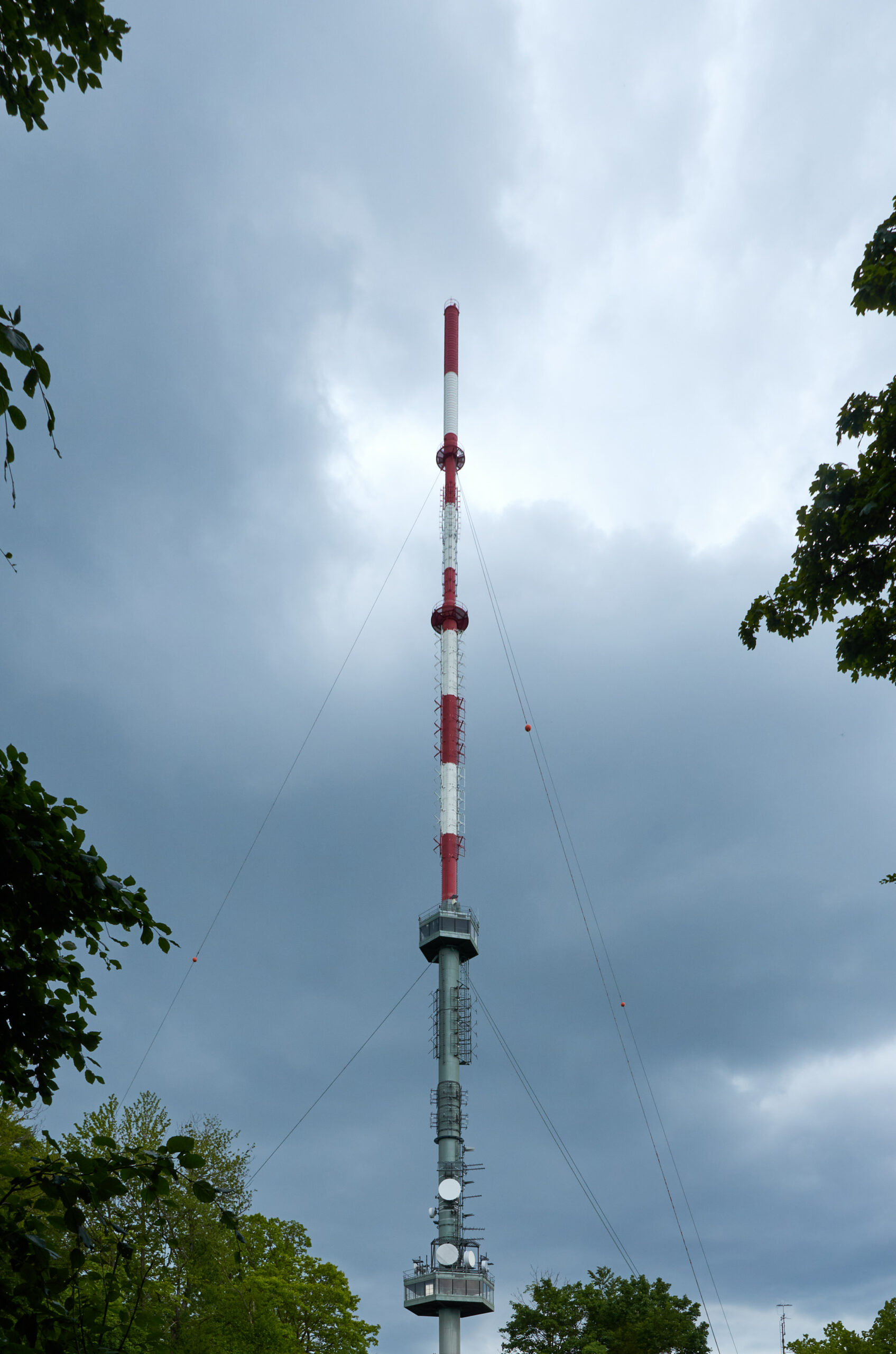
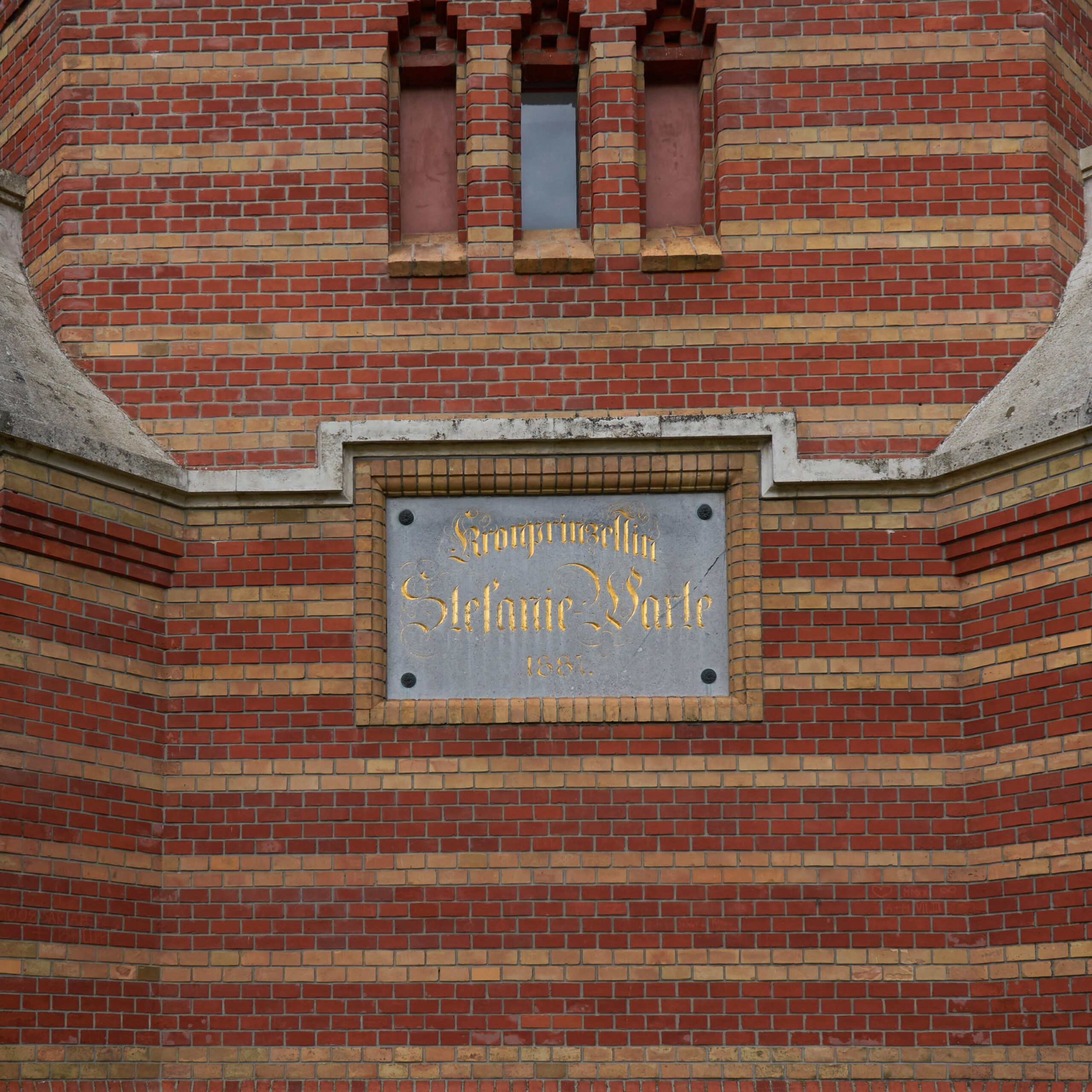
Back in the forest, I’m closing in on the Kahlerberg and my lunch spot. I’m not quite out of surprises yet though. Only a few moments walk from the bridge and the road, I come across the giant broadcast tower. As impressive as that is, it’s a smaller observation tower that catches my eye and is a kind of prelude to what’s to come. Known as the Stephaniewarte, the old brick tower was built in 1887. I was the terminus of the Kahlenbergbahn, a cog railway that ran from the D tram stop up to the Kahlerberg. The tower featured a waiting room and the observation deck on top. The railway itself closed in 1919 to regular traffic and closed completely in 1922, but the tower still remains. Due to COVID, the attraction was closed on the day I passed through, however, there are plenty of picnic tables around where you can relax and enjoy a packed lunch.
It’s also where I began to feel a little troubled. The sun that had been with me at the start of the walk had disappeared, and as I stood photographing the Stephaniewarte, I felt a single raindrop on my arm. The temperature had also dropped noticeably. Ignoring the raindrop, I pushed on to Kahlerberg, which by now was just minutes away. Before I could reach it though, I stumbled on this beautiful memorial to Kaiserin Elisabeth, Or Sisi. Sisi is Austria’s most well-loved royal, and this monument to her is very fitting.
What greeted me was surprising. I knew the Kahlerberg featured a modern hotel, viewing terrace and private university. I didn’t know there was more to see here. Breaking out of the trees, I discover the Kahlerberg in all its glory. Aside from the hotel and such, A church greets me. St. Joseph on Kahlenberg Church has an interesting history dating back to the 1600s, and in common with a lot of local history, was destroyed by the Turkish armies in 1683. It was built in 1734 but various issues came up during its lifetime, including falling attendance, Which considering it’s on the top of a mountain is hardly surprising. That said, in 1906, the Catholic group known as the Resurrectionists took over the church and dedicated it to the Polish Aristocrat John III. Sobieski fought to defend the original church and Vienna in 1683 against the Turks. Today, the Church is an important attraction for both Austrians and Polish Catholics.
I’ve reached the half waypoint, and my reward is simply the best view you’ll ever come across in Vienna. From the Terrace, you can see for miles. From Bratislava and the Slovak border to the Wienerwald and rolling hills and everything in-between, the view is simply to die for.
Trouble is afoot though, and as I eat my lunch, overlooking the church, sits becoming increasingly dark, with the wind picking up. It looks like my walk is about to get ruined. As spots of rain permeate the air, I decide that discretion is the better part of valour and I head home via the 38A bus. My hike has been interrupted by weather that wasn’t forecasted. Nevertheless, It’s been a great mornings hike, and one I intend to revisit, and finish!
Getting There.
Getting to Nußdorf and the start of Stadtwanderweg 1 is simple.
The D tram goes directly to Nußdorf and can be picked up from Wien Hautpbahnhof, around the Ring and from Heiligenstadt Bahnhof on the U4 and S-Bahn.
If you don’t fancy the climb, the 38A bus will take you all the way to Kahlerberg in around 25 minutes direct from Heiligenstadt.
Further Reading.
If you’d like to know more about the Stadtwanderweg network, or any other places in this piece, check out the links below.
Heiligenstadt Friedhof
https://www.friedhoefewien.at/eportal3/ep/channelView.do/pageTypeId/75472/channelId/-54260
Stadtwanderweg
https://www.wien.gv.at/umwelt/wald/freizeit/wandern/wege/
The Kahlenberg